Categories+
We are now able to send goods again to EU countries. Unfortunately, this only applies to paper-based goods.
We are now ABLE to send goods to the USA again. They will be despatched with Duty Paid.
We are now ABLE to send goods to the USA again. They will be despatched with Duty Paid.
Canal Shop Catalogue > Maps & Guides > Heron Maps > Heron Map - Basingstoke Canal and River Wey Navigations
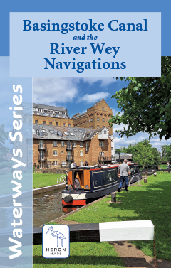
Heron Map - Basingstoke Canal and River Wey Navigations
Canal Shop Catalogue > Maps & Guides > Heron Maps > Heron Map - Basingstoke Canal and River Wey Navigations
New Products
Coupons
Customer Services
Office Hours
- We are generally in the unit/office Monday to Friday from 9:30am to 4pm
If we do not answer then please leave a message and we will respond when we are next in.
Website Information
How to get in touch with us
Call us on : 01604 93103901604 931039
Or write to us at :
The Canal Shop Company
Unit 2
First West Business Centre
Linnell Way
Kettering
NN16 8PS
United Kingdom
Or email us at our Order Email Address
© 2000 - 2026 The Canal Shop Company
